The Physics of Fuel Waste at Sea
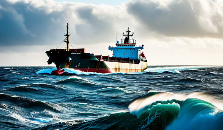
Fuel consumption on a deep-sea voyage is not a fixed cost per mile. It varies enormously depending on sea state, wind load, current direction, and wave heading relative to the vessel's course. A 50,000 DWT bulk carrier crossing the North Pacific in beam seas of 3.5 to 4 meters significant wave height will burn approximately 15 to 22% more fuel per nautical mile than the same vessel making the same speed in calm conditions. That difference, projected across a 14-day Pacific crossing at $600 per metric ton of VLSFO, can represent $180,000 to $270,000 in additional bunker cost on a single voyage.
The question is not whether ocean conditions affect fuel consumption - every chief engineer understands they do. The question is whether your operations team has the data infrastructure to quantify the effect in real time, predict it ahead of departure, and use that intelligence to optimize routing decisions before the vessel is already in a fuel-expensive sea state.
What Ocean Condition Data Actually Includes
The term "weather routing" is often used loosely to mean avoiding storms. Real ocean condition data is considerably more granular than simple storm avoidance, and the fuel-efficiency applications extend well beyond what most operators currently use.
Significant wave height (Hs) is the most directly relevant parameter for fuel consumption. Wave period matters nearly as much: long-period swell (12 to 18 seconds) at moderate height creates different resistance characteristics than short-period wind waves at the same significant height, because the vessel's pitch and roll response depends on the relationship between wave period and the vessel's natural roll period. A vessel tuned for its specific hull form will experience parametric rolling in specific swell conditions - a phenomenon that can spike fuel consumption significantly and create structural stress far above what standard heavy weather guidance anticipates.
Ocean current data is the second major variable. The Gulf Stream in the North Atlantic, the Kuroshio Current in the North Pacific, and the Agulhas Current around southern Africa all represent meaningful route optimization opportunities. A fully-laden VLCC transiting eastward across the North Atlantic can save 18 to 36 hours of voyage time by routing through the core of the Gulf Stream - translating to both fuel savings and improved schedule reliability. Routing against a 2-knot adverse current, by contrast, can increase fuel consumption by 8 to 12% above flat-water baseline.
Wind-induced resistance (wind resistance force and the resulting additional shaft power demand) adds a third dimension. Head winds above Beaufort Force 6 create resistance that requires additional engine load to maintain speed, while following winds can marginally reduce power demand. For most commercial vessels, wind resistance is a secondary factor compared to wave resistance, but in high-wind trade route segments - South Atlantic, Southern Ocean, North Sea - it becomes operationally significant.
The Data Sources Behind Ocean Condition Forecasting
Modern ocean condition forecasting draws from multiple sensor networks that did not exist in their current form until the early 2010s. Understanding the source architecture helps fleet operators evaluate the quality and confidence intervals of the forecasts they receive.
Numerical Weather Prediction (NWP) models - primarily the ECMWF (European Centre for Medium-Range Weather Forecasts) ensemble and the NOAA Global Forecast System (GFS) - form the foundation of offshore weather forecasting. These global models run at grid resolutions of 9 to 28 kilometers and provide forecasts out to 10 to 15 days, though forecast skill degrades significantly beyond day 7. Wave modeling using WAVEWATCH III or similar spectral wave models derives from NWP wind fields and produces significant wave height, peak period, and directional spreading forecasts on matching spatial grids.
These model outputs are validated and corrected using real-time observations from three source networks. The Argo float program maintains approximately 4,000 autonomous profiling floats distributed across the global ocean, measuring temperature and salinity profiles from the surface to 2,000 meters depth - data used for sea surface temperature correction and mixed-layer depth estimation. Weather buoys maintained by NOAA, the European Meteorological Services, and national hydrographic offices provide hourly surface condition observations. Satellite altimetry from missions including Sentinel-6 and Jason-3 provides sea surface height measurements used for geostrophic current estimation and wave validation.
The Cetasol platform ingests these data streams continuously and applies them to route-specific condition forecasting. Rather than presenting a generic ocean forecast, the platform builds a corridor-based forecast along a vessel's planned or actual track, calculating the expected sea state and current conditions at each waypoint as a function of the vessel's projected arrival time at that waypoint.
Translating Ocean Data into Routing Decisions
The translation from ocean condition data to actionable routing decisions requires a vessel performance model - a function that maps speed, heading, displacement, and sea state to fuel consumption rate. Without this model, ocean condition data remains an informational product rather than an optimization tool.
Vessel performance models range from simple lookup tables based on hull form and engine power curves to high-fidelity computational fluid dynamics (CFD) models calibrated against sea trial data and operational voyage records. For fleet-level optimization, the appropriate level of complexity is typically a parametric resistance model that accounts for hull form factor, added wave resistance (using Salvesen-Tuck-Faltinsen or similar methods), wind resistance, and fouling correction factors.
The fouling correction is often underappreciated. Hull biofouling increases effective hull roughness over time, raising viscous resistance and increasing fuel consumption. A vessel with 18 to 24 months of accumulated fouling may have a 10 to 15% higher base fuel consumption than a freshly-drydocked sister vessel on the same route in identical conditions. Ocean condition optimization on a fouled hull produces smaller absolute fuel savings, because the base consumption is already elevated. Tracking fouling status as part of the performance model - using paint age, dock records, and performance degradation curves - is necessary for accurate optimization.
Real-World Fuel Savings: What Operators Are Actually Achieving
The commercial case for ocean condition-informed routing is strongest on long deep-sea voyages where route flexibility exists. Coastal and near-sea voyages offer limited routing options and shorter exposure to oceanic swell patterns, so the marginal benefit of sophisticated optimization is lower.
On transoceanic routes, operators using integrated ocean condition routing report fuel savings of 3 to 8% compared to great-circle or standard waypoint routing. The variance depends primarily on route season, vessel type, and how aggressively the vessel master is willing to deviate from the nominal track. A 5% average fuel saving on a Panamax bulker operating 12 voyages per year at $600/mt bunker cost represents approximately $650,000 to $900,000 in annual savings - well in excess of the cost of any monitoring platform.
Beyond direct fuel savings, ocean condition routing also reduces vessel stress and cargo damage incidents in heavy weather. Insurance underwriters are beginning to incorporate verified weather routing compliance into P&I and hull premium calculations. As discussed in our article on how maritime operators are using weather routing to cut voyage time, the operational benefits extend beyond the bunker bill to schedule reliability and cargo safety.
Why Ocean Data Integration Fails in Practice
Despite the clear economic case, a significant proportion of fleet operators using weather routing services are not capturing the full available benefit. The failure modes are instructive.
The most common is the advisory-versus-operational gap. Weather routing vendors issue recommended routes, but vessel masters have discretion to deviate - and often do, based on their own experience, schedule pressure, or simple habit. When there is no post-voyage analysis comparing the actual route sailed against the recommended route, and no systematic review of what fuel consumption would have been on the alternative, operators cannot demonstrate the value of routing compliance or identify where master discretion is costing money.
The second failure mode is forecast resolution mismatch. Using a coarse global model forecast to optimize routing in an area with strong mesoscale oceanographic features - the Gulf of Mexico, the Sea of Japan, the Tasman Sea - produces recommendations that may be systematically incorrect for local conditions. Regional high-resolution models and real-time buoy data integration are necessary to achieve the full performance of ocean condition routing in these areas.
The Cetasol platform addresses both of these by combining route recommendation generation with post-voyage performance analysis that explicitly quantifies the fuel delta between the sailed route and the optimal route, using verified condition data for the actual voyage period.
Optimize Your Fleet's Ocean Route Performance
Cetasol integrates multi-source ocean condition data with vessel performance models to deliver route-specific fuel optimization. Schedule a demo to see how the platform handles your specific routes and fleet types.
Request a Demo Back to Blog