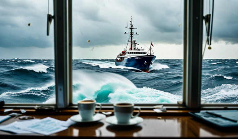
The North Pacific in winter is a hostile place for commercial shipping. A great-circle route from Yokohama to Seattle passes directly through some of the most severe weather systems on Earth, with sustained winds above 50 knots, wave heights exceeding 12 meters, and powerful eastward-flowing currents that can extend voyage times by 18 – 36 hours for westbound vessels. A master who takes the great-circle route in January because it's geometrically shortest may arrive four days late with cargo damage, a stressed crew, and a vessel showing signs of structural fatigue — and will have consumed 15% more fuel than a vessel that routed farther south to avoid the worst of the system.
Weather routing is the discipline that solves this problem by finding the route that minimizes voyage time, fuel consumption, and safety risk under actual forecast weather conditions — not the theoretically optimal route under calm-water assumptions. It's been practiced by specialist routing services since the 1950s, but the combination of high-resolution numerical weather prediction models, vessel polar diagram analysis, and modern optimization algorithms has transformed it from an art into a precise analytical capability that any fleet operator can access in real time.
The Physics of Weather Impact on Vessel Performance
Understanding why weather routing works requires understanding how environmental conditions affect vessel resistance and performance. A vessel's fuel consumption at a given speed is determined by the total resistance it must overcome, which has three components: hull resistance in calm water (a function of speed, displacement, and hull form), wind resistance (depends on wind speed relative to the vessel, vessel above-water profile area, and angle of incidence), and wave-induced resistance.
Wave-induced resistance — technically known as added resistance in waves — is the dominant variable in heavy weather routing. When a vessel encounters head seas, each wave exerts a retarding force on the hull as it is deflected. The magnitude of this force depends on wave height, wave period, wave direction relative to the vessel's heading, and the vessel's own dimensions and form. For a typical Panamax container ship in seas with significant wave height of 4 meters and a wave period matched to the vessel's natural pitch period, added resistance can exceed the calm-water resistance — effectively more than doubling the total fuel required to maintain a given speed.
Ocean currents add a further variable. The Kuroshio Current off Japan, the Gulf Stream in the North Atlantic, and the powerful Antarctic Circumpolar Current can run at 2 – 4 knots over wide areas. A vessel making 15 knots through the water while fighting a 2-knot headcurrent is only making 13 knots over ground — and is burning fuel at the 15-knot rate to achieve 13-knot progress. Routing to exploit favorable currents, or route around adverse ones, can contribute 5 – 15% to net voyage speed with no fuel cost penalty.
Vessel Polar Diagrams and Performance Modeling
The mathematical foundation of weather routing is the vessel polar diagram — a representation of vessel speed as a function of wind and sea conditions at a specified power setting. Think of it as a map of the vessel's performance envelope: at a given engine output (expressed as shaft power or RPM), the polar diagram shows what speed the vessel achieves in different sea states and headings relative to the weather.
Accurate polar diagrams are constructed from a combination of model basin testing (used in vessel design), sea trial data (measured under controlled conditions), and operational data collected across the vessel's service life. The operational data component is increasingly valuable because it captures the vessel's actual current condition — a vessel with significant hull fouling has a degraded polar diagram compared to its sea trial baseline, and routing algorithms that use the sea trial diagram will produce systematically optimistic ETA predictions.
Modern weather routing platforms maintain vessel-specific, condition-adjusted polar diagrams that are continuously updated based on actual speed-power relationships observed during recent operational data. The difference between a routing algorithm using an 18-month-old sea trial polar diagram and one using a current operational polar diagram can be significant — particularly for older vessels or those approaching their drydock interval when hull fouling is at maximum. Using stale performance data produces routes that look good on paper but fail to deliver predicted ETAs, eroding trust in the routing system among masters and commercial teams.
Optimization Algorithms: Finding the Best Route
Given a numerical weather forecast, a vessel polar diagram, and departure and arrival ports, the weather routing problem is fundamentally an optimization problem: find the route through a time-evolving weather field that minimizes some objective function (voyage time, fuel consumption, or a weighted combination of both) subject to constraints (maximum wave height for structural safety, avoid ice edge, stay within chart coverage). This is a computationally demanding problem that was impractical without modern computing resources.
Several algorithmic approaches are used in commercial routing systems. Isochrone methods construct the set of all positions reachable from the departure point at successive time steps, using the vessel's polar diagram and forecast weather to calculate achievable speed at each heading from each position. The most efficient path to the destination is then traced back through the isochrone layers. Dynamic programming approaches, genetic algorithms, and network-based shortest-path algorithms are also used, each with different trade-offs between computational efficiency and optimality guarantees.
A key practical consideration is how weather forecast uncertainty is handled. Weather forecasts become progressively less accurate beyond 5 – 7 days, and a 15-day transoceanic voyage will always involve the final week of travel under weather conditions that weren't forecast at departure. Robust routing algorithms generate not just a single recommended route but a family of routes under different weather scenarios, along with guidance on decision points where the vessel should request an updated routing recommendation based on the latest forecast. Automated re-routing — where the platform continuously recalculates the optimal route as new forecast data arrives and sends updates to the vessel — is now standard practice on well-managed fleets.
Quantifying the Savings: What Weather Routing Actually Delivers
Industry studies consistently show weather routing delivers fuel savings of 2 – 8% on deep-sea voyages, with savings concentrated on weather-sensitive routes and seasons. The highest savings are seen on North Pacific and North Atlantic winter crossings, where optimal routing around severe weather systems can reduce voyage fuel consumption by 10 – 15% compared to fixed great-circle routes. Summer crossings on the same routes typically see more modest benefits, though even in benign conditions, current optimization adds value.
Voyage time savings are sometimes even more significant commercially. A vessel that would take 18 days on a fixed route may arrive in 17 days on a weather-optimized route by exploiting favorable current systems and avoiding adverse headwinds — even if the weather-optimized route is longer in nautical miles. This is particularly common on routes with access to strong favorable currents: the eastbound North Pacific route from Japan to North America can be shortened by 12 – 24 hours using Kuroshio and North Pacific Current assistance, representing enormous commercial value on tight liner schedules.
Cargo damage reduction is an underappreciated benefit of weather routing. SOLAS requirements and best practices call for avoiding conditions likely to cause cargo damage, but these decisions are often made reactively — the master slows down or alters course after encountering severe conditions rather than routing proactively to avoid them. Vessels carrying refrigerated cargo, automotive, or breakbulk cargo have strong incentives to avoid heavy weather that a bulk carrier might tolerate. For container lines with contractual responsibilities for cargo condition, the insurance and claims cost reduction from proactive weather routing is a meaningful additional benefit beyond the fuel savings.
Integration with Fleet Management and Charter Party Requirements
Weather routing advice is only valuable if it's actually followed — and implementing it in practice requires integration with the fleet management workflow and charter party compliance monitoring. Charter parties typically specify the conditions under which weather routing deductions apply: if a vessel fails to achieve contracted speed and consumption, the charterer may claim a weather allowance only if the vessel was genuinely impacted by adverse weather to a degree that would have affected a "good weather" vessel. Documenting weather conditions encountered and the routing decisions made — including the basis for those decisions — is essential for protecting the operator's commercial position in charter party disputes.
Automated integration between the routing platform, the noon report submission system, and charter party performance calculations closes this loop. When a vessel deviates from its contracted speed performance, the platform can automatically generate a weather analysis report showing the forecast and observed conditions that impacted performance, enabling a data-supported weather claim rather than a manual reconstruction exercise. This document trail has proven decisive in numerous charter party arbitrations where the quality of weather documentation was the difference between a successful weather allowance claim and a disputed under-performance claim.